Willamette River Context Map
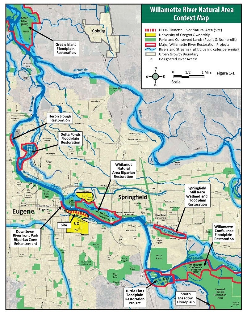
Context Map: Eugene and Springfield have numerous waterfront restoration projects and parks.
group1
Action Plan Maps
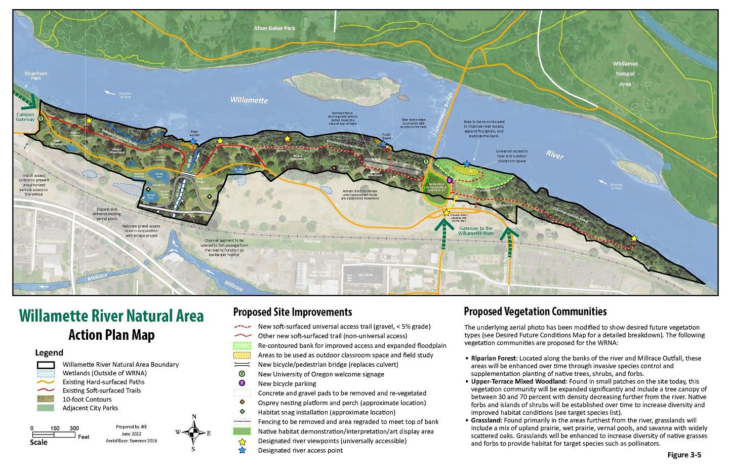
Action Plan Map: Future Conditions
group2
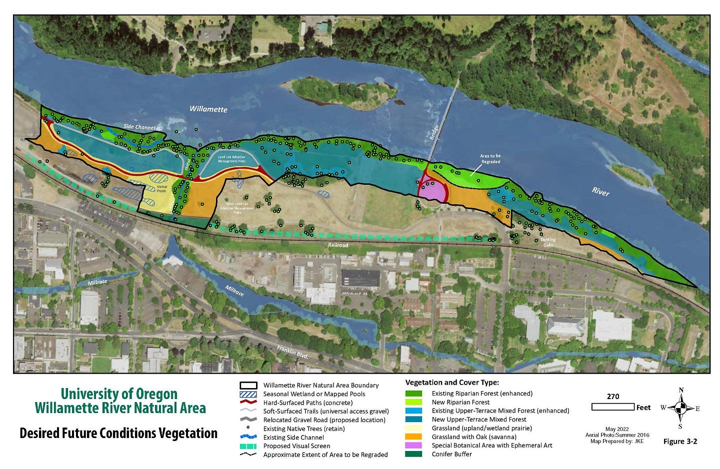
Desired Future Conditions Map: Vegetation & Habitat
group2
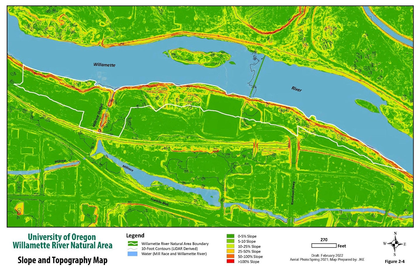
Slope & Topography Map
group2
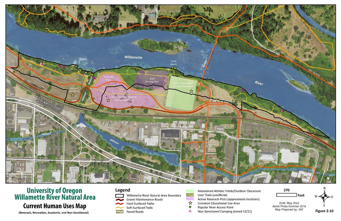
Current Human Uses Map
group2
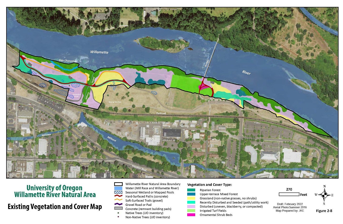
Existing Vegetation & Cover Map
group2
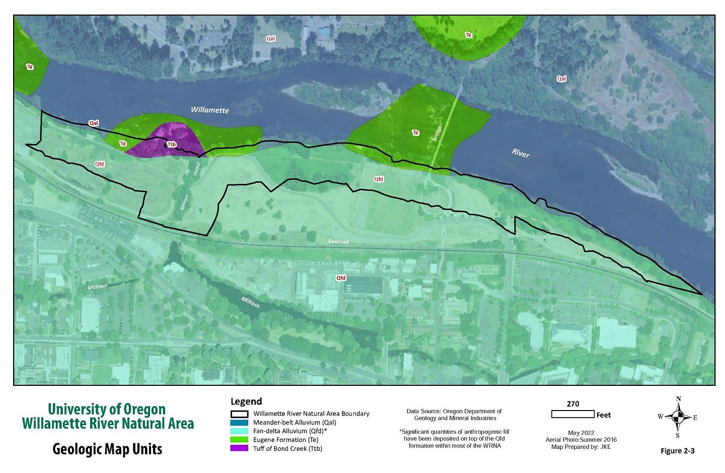
Geologic Map
group2
Historical Maps
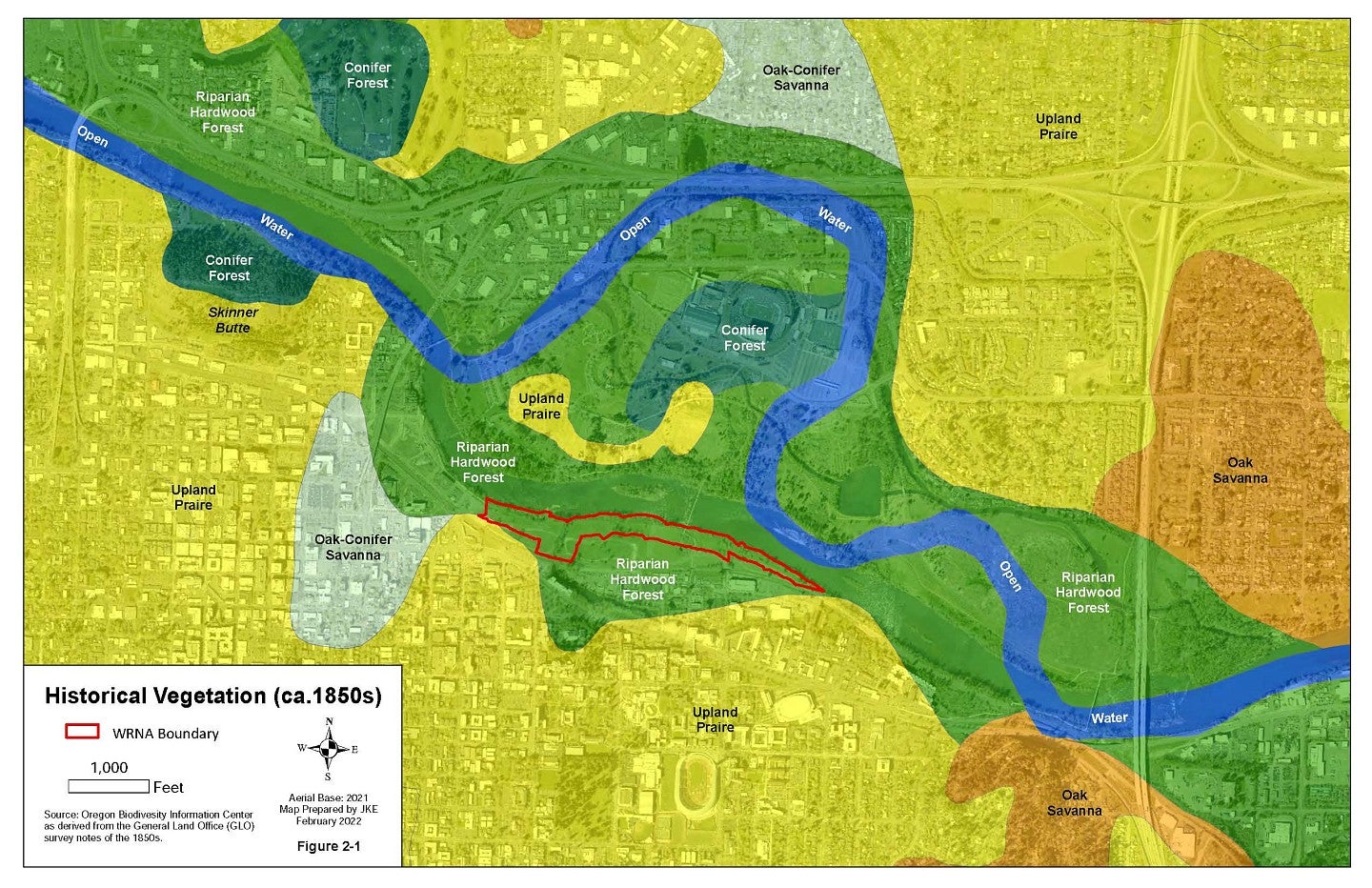
Historical Vegetation and River Flow (1850s)
group3
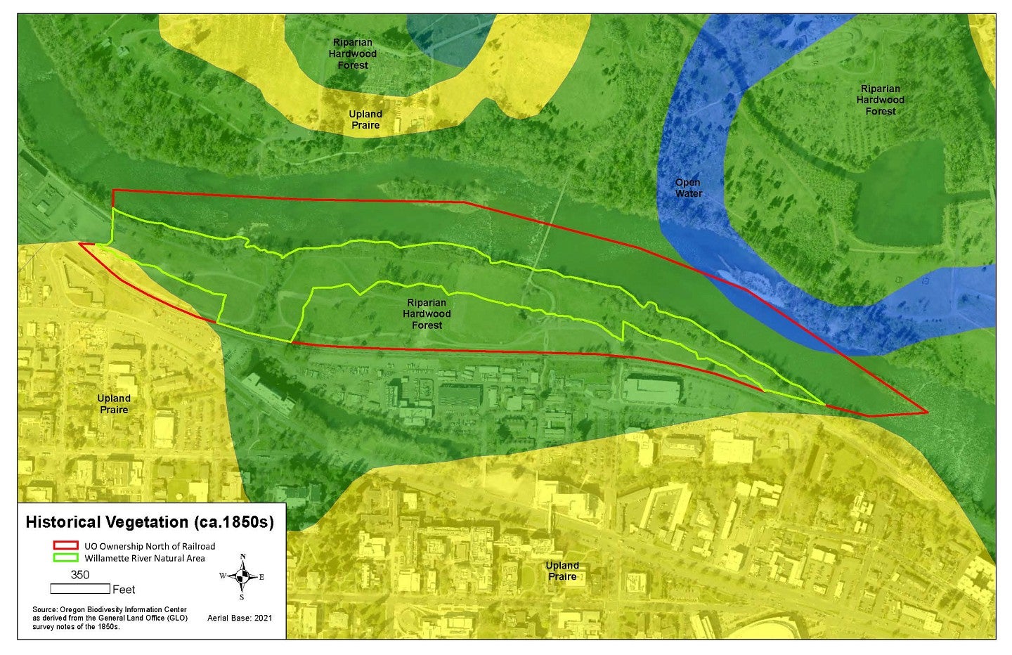
Historical Vegetation Map (1850s)
group3
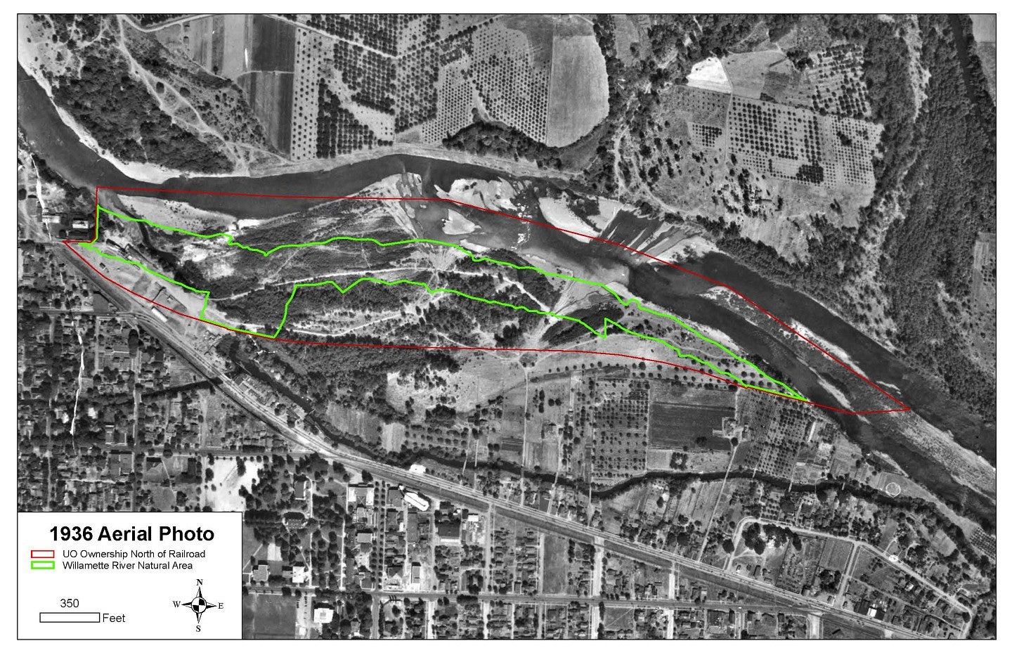
1936 Aerial Photo
group3
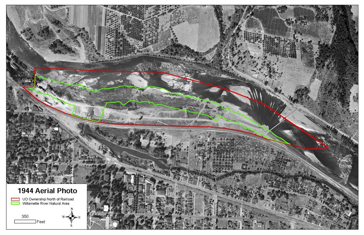
1944 Aerial Photo
group3
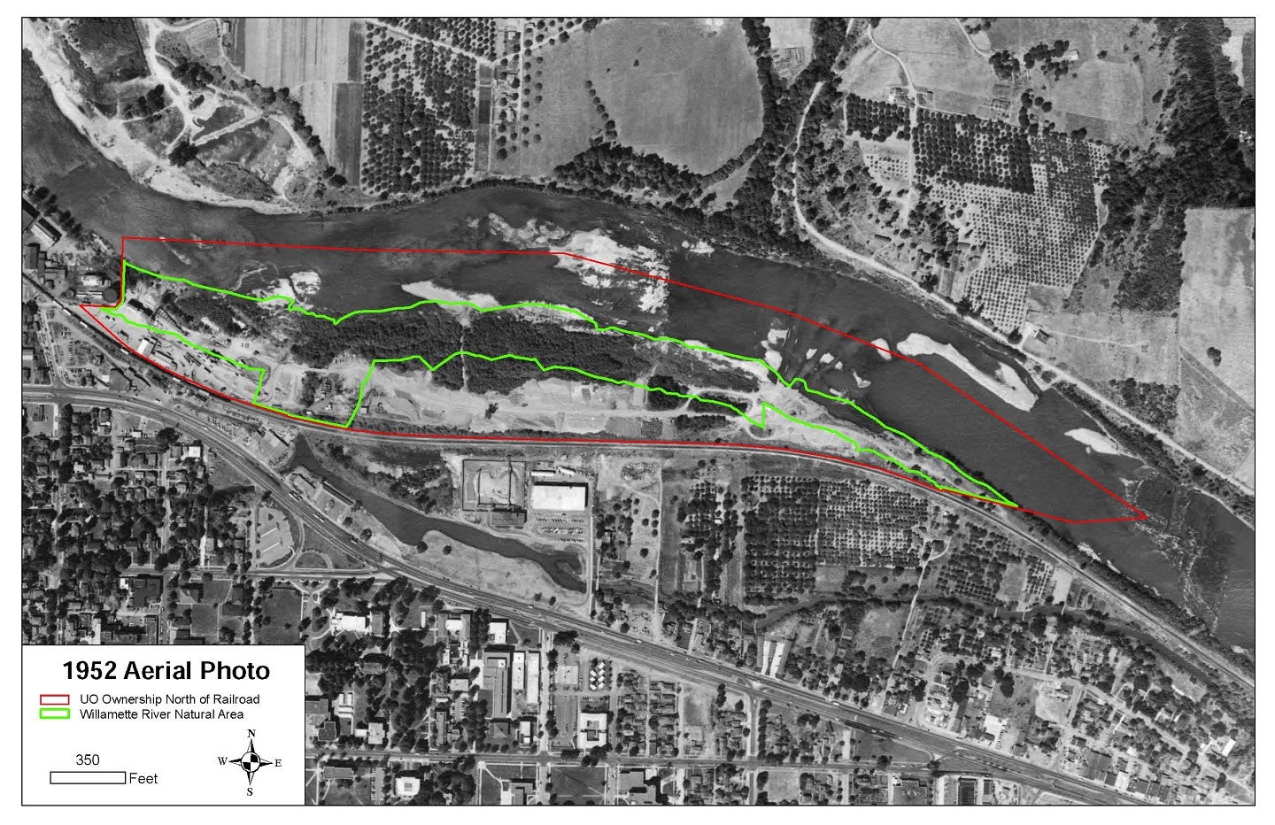
1952 Aerial Photo
group3
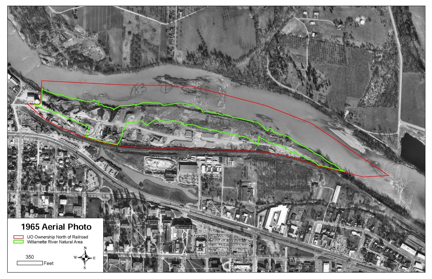
1965 Aerial Photo
group3
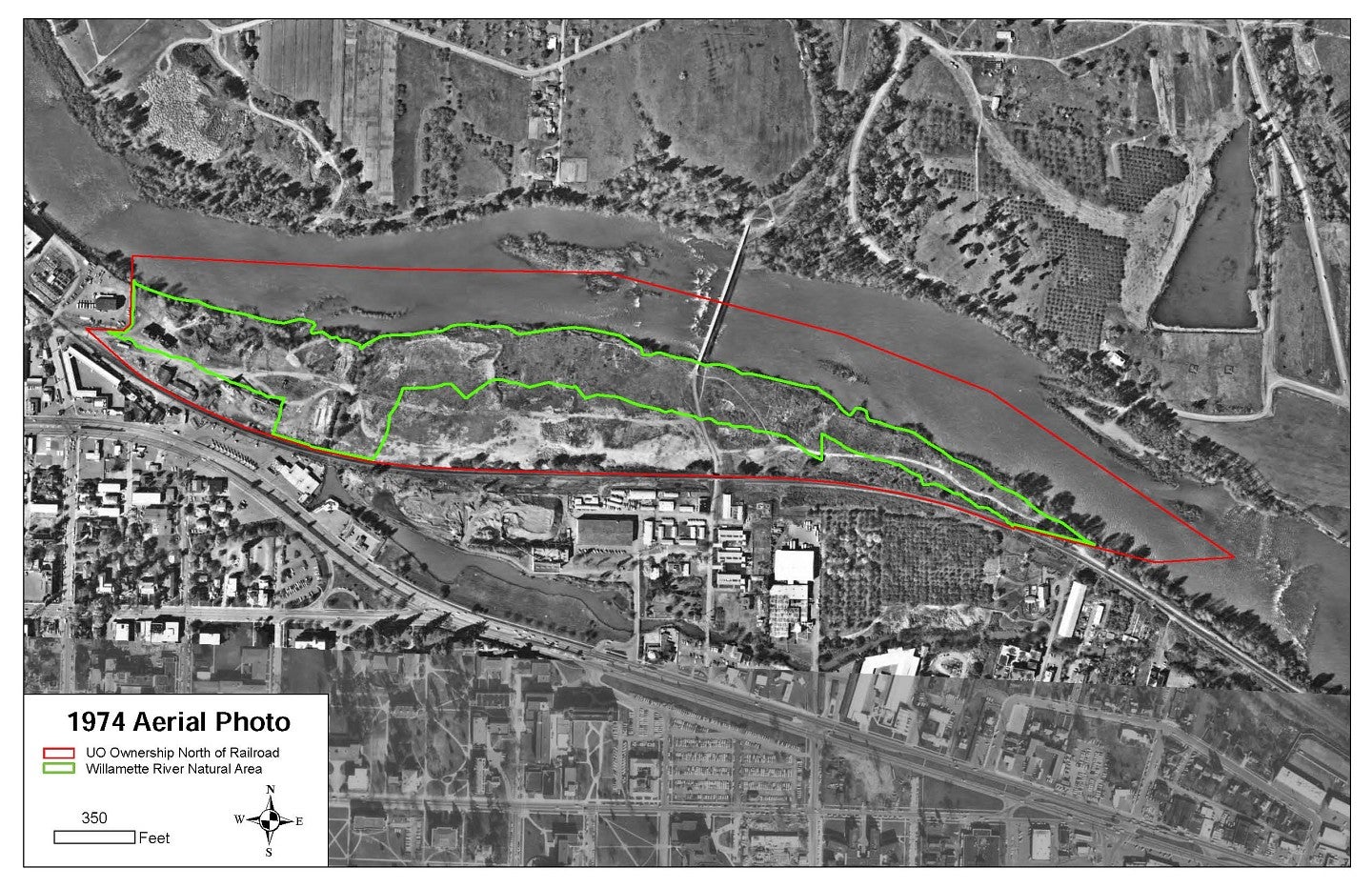
1974 Aerial Photo
group3
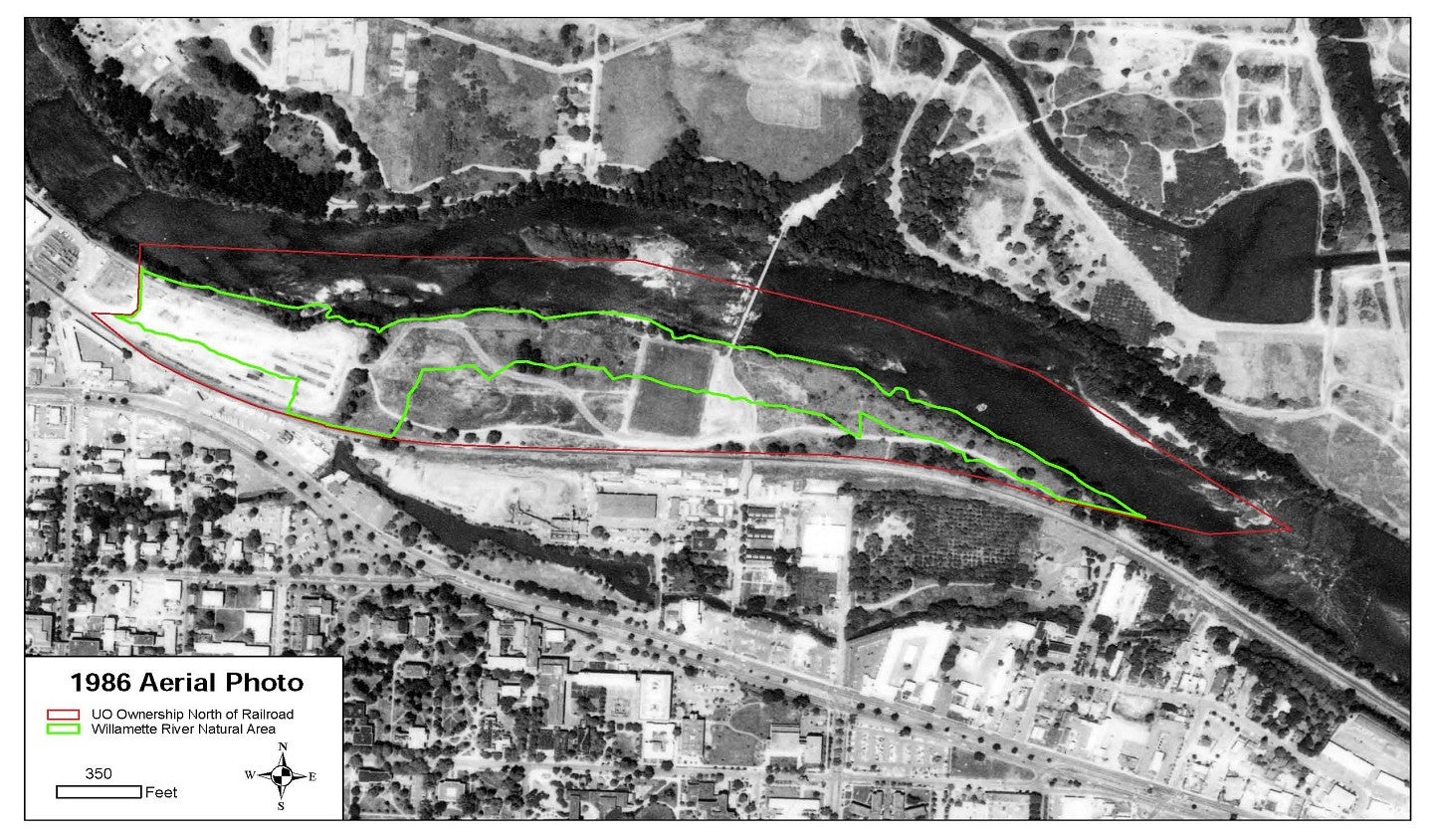
1986 Aerial Photo
group3
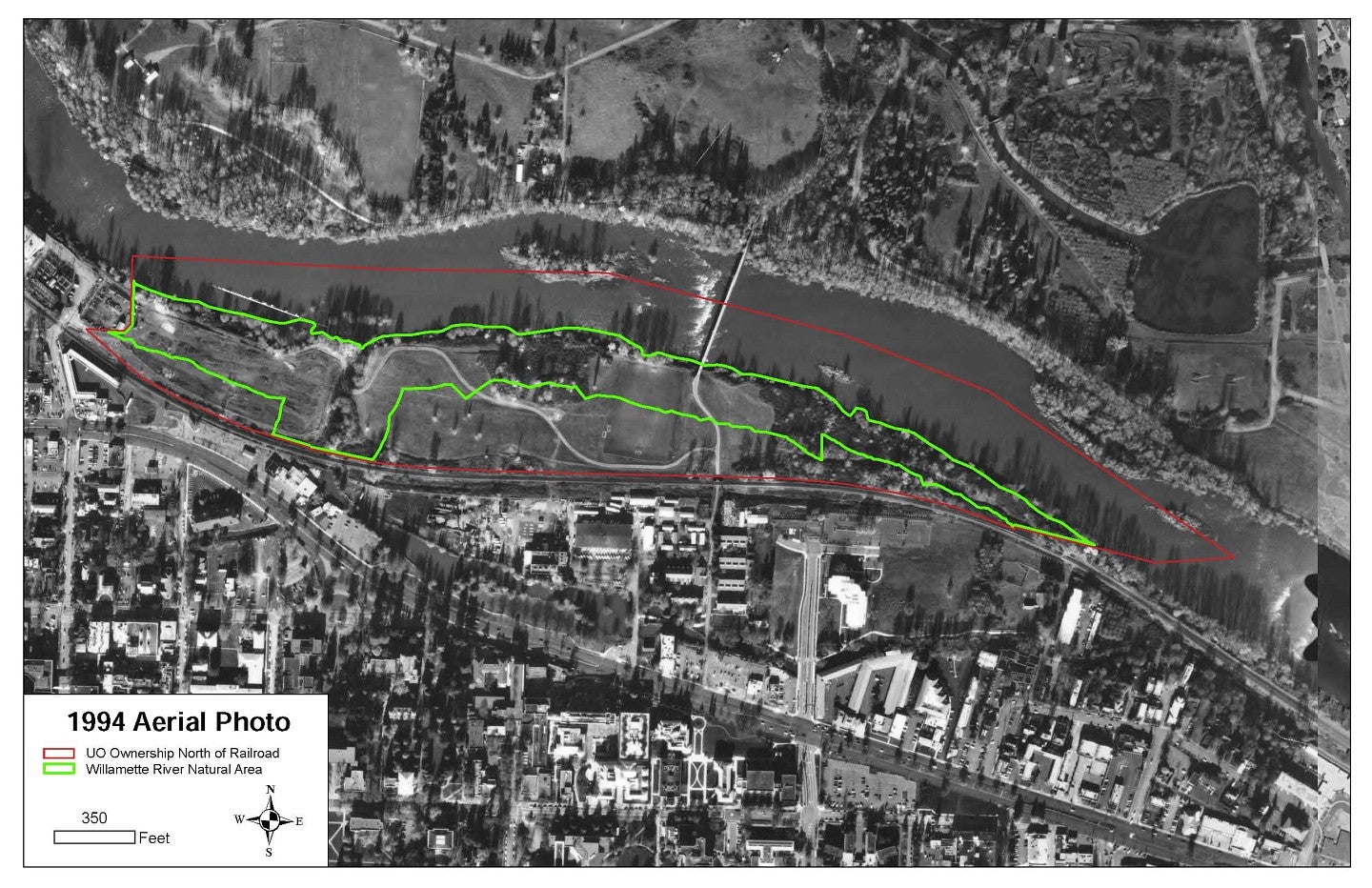
1994 Aerial Photo
group3
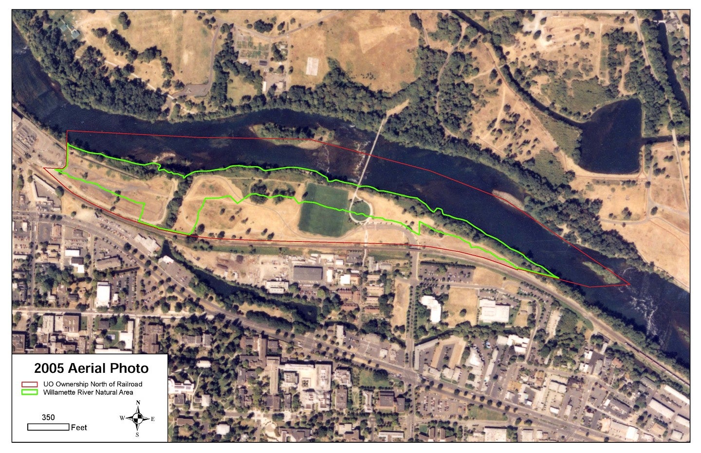
2005 Aerial Photo
group3
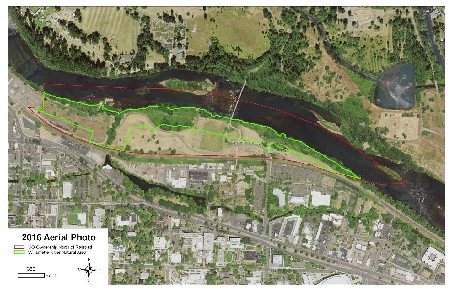
2016 Aerial Photo
group3
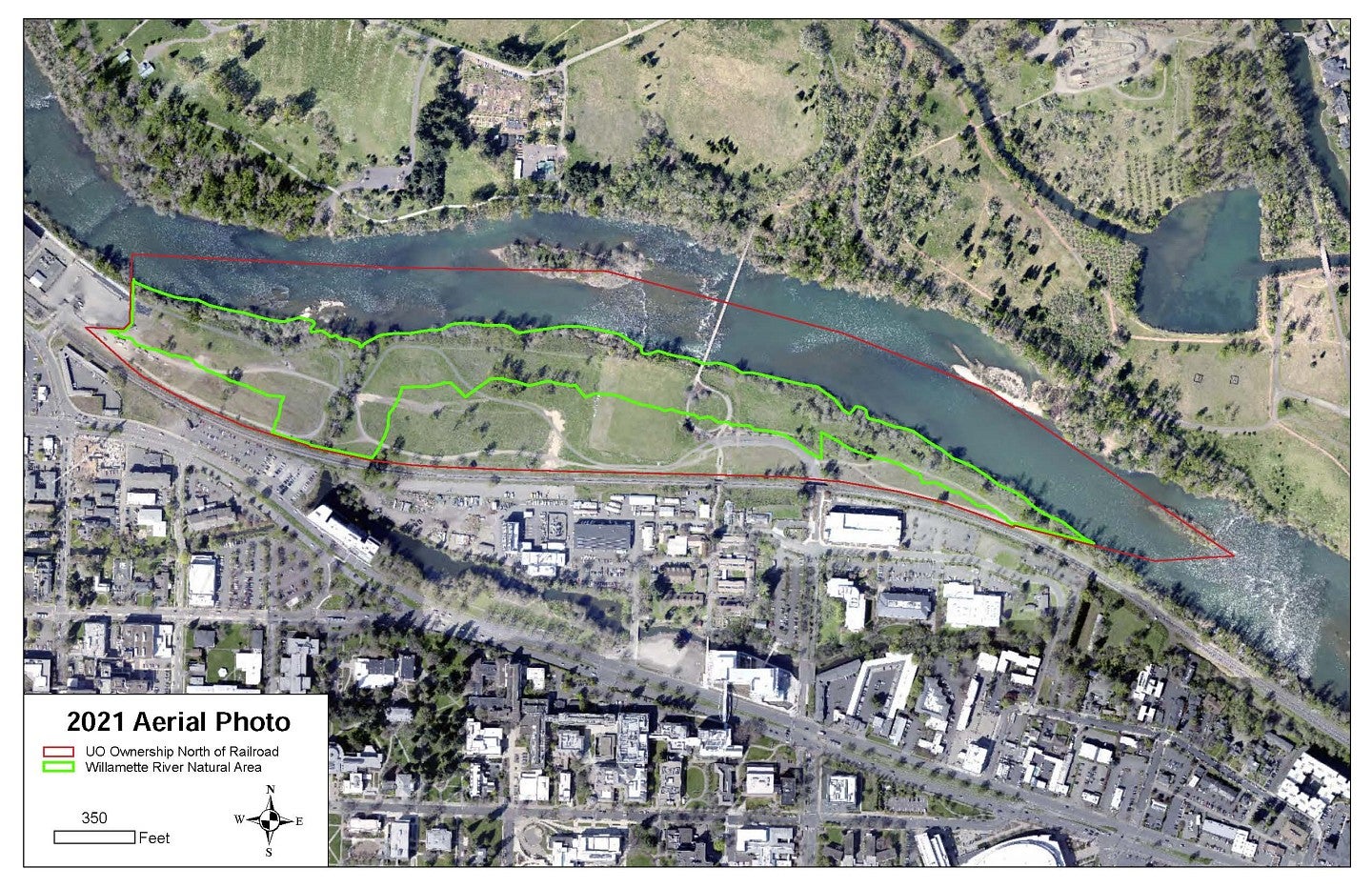
2021 Aerial Photo
group3
