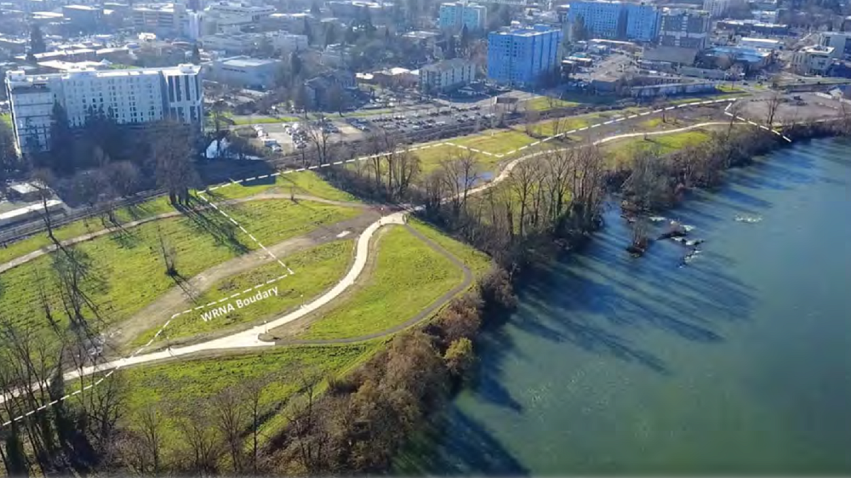
Pictured: The Central portion of the Willamette River Natural Area, taken February 2022.

The Willamette River Natural Area (WRNA) consists of 24 acres of designated open space within the University of Oregon campus situated along the south bank of the Willamette River, about 3.5 miles below the confluences of the Coast Fork and the Middle Fork, and about 6.5 miles above the confluence with the McKenzie River.
Though the site has been heavily impacted by industrial land uses beginning in the early 1900s, its current minimally managed condition provides habitat conditions that support a range of plant and wildlife species. With an increase in attention and resources, the site has significant potential for improvement.
Interested in seeing more detail? We have historical maps here!
The land of the Willamette River Natural Area has an extensive cultural and natural history, from thousands of years ago to present day, which you can learn more about with this timeline.
~14,000 – 18,000 BP (Before Present): A series of massive Missoula ice dam floods impounded water in the Willamette Valley, including much of current day Eugene, and deposited dense layers of silt.
~13,000 BP to present: Kalapuya people inhabit the Willamette Valley. Early residents were likely highly mobile hunting and gathering family groups who managed the landscape with fire. Camas ovens, projectile points, milling stones, and vegetation provide evidence of their long stewardship of the land. At the time of early European contact (French or English fur trappers in the 1600 and 1700s) and White colonial settlement (mid 1800s), there were known to be over a dozen distinct Kalapuyan dialect groups in the valley.
1846: Eugene Skinner files land claim near Skinner Butte. By this point, the Kalapuyan population throughout the valley was significantly decimated due to displacement and diseases brought by settler-colonialists and fur trappers.
1851: The Eugene Millrace was completed to produce power for surrounding mills and produced waterpower until around 1928. The Millrace and outfall Channel remain today, fed by stormwater runoff and periodic pumping from the river.
1851-1855: The remaining Willamette Valley Kalapuyan peoples were forcibly removed from their ancestral homelands by treaty and sent to temporary reserves scattered through the valley, significantly impacting thousands of years of heritage.
1850s: The area of the present WRNA was dominated by riparian forest with the main river channel meandering through a large active floodplain with numerous side channels and alcoves. The General Land Office land survey of the 1850s showed the main river channel at the time located much further to the north (see Figure 2-1: Historical Vegetation Map).
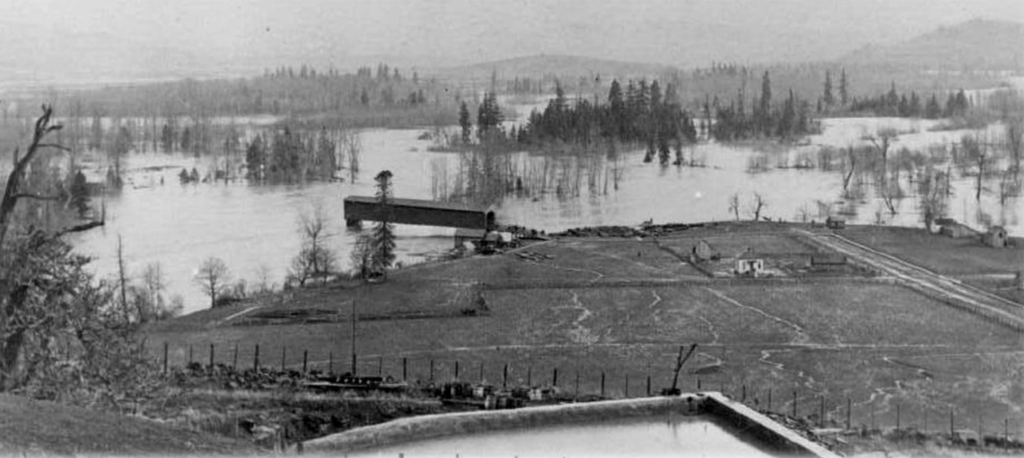
1861: The largest recorded Willamette River flood event completely inundating the current WRNA area and much of downtown Eugene. View of Willamette River in Eugene from Skinner Butte, looking east toward Willamette River during the 1890 flood. Ferry Street covered bridge at center (source: Lane County History Museum).
1862: Eugene City incorporated.
1871: The Oregon and California railroad reaches Eugene and initially ran parallel to Franklin Boulevard.
1876: University of Oregon founded.
Pictured: The Willamette River Natural Area as seen from Skinner's Butte (facing east) during the 1890 flood.

1890: Another massive flood event occurred resulting in significant river migration.
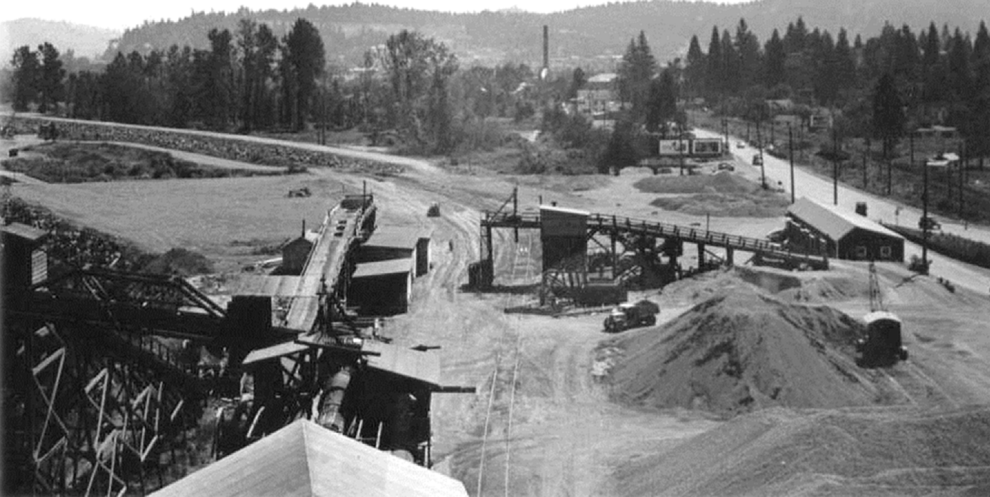
1900: The Eugene Sand and Gravel Company, located on what is now the University of Oregon riverfront property, mine the river and surrounding area and later operate an asphalt and concrete plant in the area south of the railroad near the Millrace outfall.
1906: A coal carbonization plant constructed on the western edge of the property and operated until 1910.
1940: The railroad was relocated from the area parallel to Franklin Boulevard to its current location.
Pictured: The Eugene Sand & Gravel Company in operation in the Willamette River Natural Area in 1942.

1950s: Much of the remaining riparian vegetation was stripped from the property to accommodate quarrying.
1950s and 1960s: A total of six large flood control dams were constructed by the U.S. Army Corps of Engineers on the Willamette River system above Eugene, significantly reducing the risk of severe flooding. Winter and spring peak flows are typically now much lower than historica levels and summer and fall flows higher due to highly-managed dam releases.
1964: Major flooding occurs on the Willamette River.
1964: Eugene Sand and Gravel Company begins relocating operations to the confluence of the McKenzie.
1965: The Millrace outfall is present on historical aerial photos in its current location.
1968: The University purchases much of the riverfront property from the Eugene Sand and Gravel Company.
1970: The current bicycle and pedestrian bridge (now named the Frohnmayer Bridge) was constructed.
1972: A railroad underpass for pedestrians was constructed, making a direct connection from campus to bridge, path system, and Autzen Stadium.
1965-1970s: Fill of unknown origin was placed and graded across much of the former quarry site to prepare the area for future development.
1978: North Campus Master Plan approved for construction of playing fields on the riverfront (one completed).
1980s: The South Bank path was constructed.
1985: The Eugene City Council creates the Riverfront Park Special Development District in the north campus area.
1989: The UO develops the Riverfront Research Park (RRP) Master Plan. Subsequent RRP development occurred to the south of the railroad, leaving the area between the river and railroad largely undeveloped, with limited changes occurring in this area and minimal landscape management practices.
1998: A second railroad underpass was constructed (Riverfront Parkway) to provide vehicular access for planned Riverfront Research Park development. This road is only open to bicycles, pedestrians, and maintenance/public safety vehicles to the north of the railroad.
2006: University and EWEB completes various site cleanup activities, which were initiated beginning in 1984 on the western portion of the UO-owned property (area leased to EWEB for utility storage) and the Oregon Department of Environmental Quality issues a conditional “No Further Action Recommendation” in 2009 for the work completed.
2009: The RRP Conditional Use Permit expires, is extended to 2012 before expiring again.
2014: Campus Physical Framework Vision Project completed, which assessed potential for campus growth, providing the basis for subsequent land use planning.
2018: The City of Eugene approves the UO North Campus Master Plan and Conditional Use Permit which is in effect for 30-years and designates much of the land along the river as open space.
2021: The Campus Plan is amended establishing the 24-acre WRNA for its intended use of habitat, recreation, and education.
2021: The City of Eugene reconstructs the South Bank Path to current city standards, including the addition of the university’s campus standard for lighting, and relocates a portion of the path to be further from the river.
2021: EWEB completes construction of a major water main through the university’s riverfront, a portion of which is under the WRNA.
2022: UO develops a 20-year Landscape Management Plan to guide restoration enhancement, landscape management activities, and compatible recreational and educational uses.
2024: UO hires first Natural Areas Steward and program is launched!
